Lake Baikal
The deepest and oldest lake on Earth. Siberia's Lake Baikal is about 1,640 m deep and holds about a fifth of the world's unfrozen surface fresh water. How it formed and when to go.
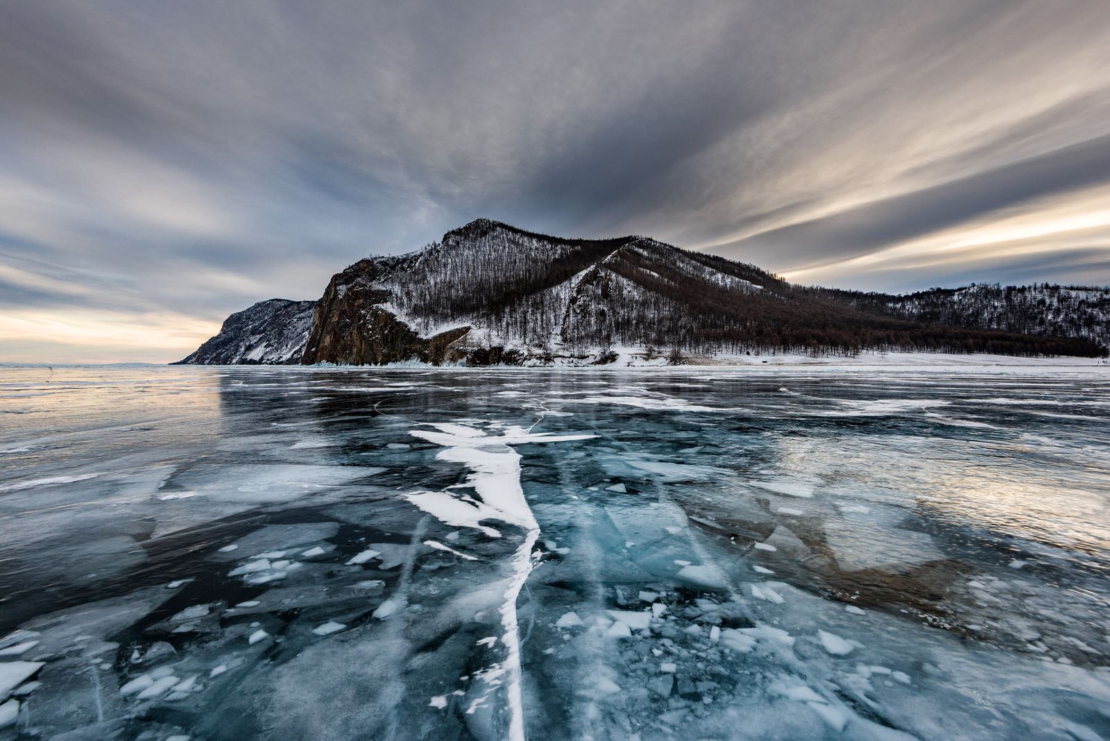
Lake Baikal in winter: Sergey Pesterev, CC BY-SA 4.0
A lake in a crack in the continent
Lake Baikal fills a rift valley in southern Siberia, where the Earth's crust is slowly being pulled apart. The rift began opening about 25 to 30 million years ago, which makes Baikal the oldest lake known. Most lakes fill with sediment and vanish within tens of thousands of years. Baikal survives because the rift keeps widening and deepening faster than it can fill.
The lake reaches about 1,642 m deep, the deepest of any lake on Earth, and beneath its floor lie several kilometers of sediment. The basin is still active: small earthquakes are common around its shores.
Video: Lake Baikal: A biological treasure trove | SLICE (SLICE), embedded from YouTube.
One lake holds about a fifth of Earth's unfrozen surface fresh water
Lake Baikal is the deepest and oldest lake on Earth and holds roughly 20 percent of the world's unfrozen surface fresh water.
YouTube @GeographicalEffect (launching soon). Photos in this Short: Baikal, Cape Burhan, Olkhon Island, Lake Baikal, Russia.jpg - Vyacheslav Argenberg (CC BY 4.0) via Wikimedia Commons | Lake Baikal in winter.jpg - Sergey Pesterev (CC BY-SA 4.0) via Wikimedia Commons | Ice cave on Olkhon island.jpg - Sergey Pesterev (CC BY-SA 4.0) via Wikimedia Commons | Baikal ice on sunset.jpg - Sergey Pesterev (CC BY-SA 4.0) via Wikimedia Commons | Panorama of lake Baikal.jpg - Sergey Pesterev (CC BY-SA 4.0) via Wikimedia Commons | Lake Baikal, Maloye More Strait at sunrise,
A fifth of the world's fresh surface water
Baikal looks long and narrow on the map, about 636 km from end to end, but its depth gives it enormous volume. It holds about 23,600 cubic kilometers of water, roughly a fifth of all the unfrozen fresh water sitting on the planet's surface, more than all five of North America's Great Lakes combined.
More than 300 rivers flow in, but only one, the Angara, flows out. The water is famously clear, and in places you can see many meters down. Tiny crustaceans in the lake help keep it clean by filtering algae and bacteria.
Life found nowhere else
Millions of years of isolation have produced a remarkable set of species. The best known is the nerpa, or Baikal seal, one of the only seals in the world that lives entirely in fresh water. How its ancestors reached a lake in the middle of Asia is still debated. The lake also holds the golomyanka, a translucent fish that gives birth to live young, and many endemic snails, sponges and crustaceans.
Baikal became a UNESCO World Heritage Site in 1996. Pollution from industry and towns, along with warming winters and changing ice, are ongoing concerns for scientists who study it.
Ice and summer seasons
In winter the lake freezes over, usually from January into May. February and March are popular for walking, skating and driving across the clear blue ice, which cracks and booms as it shifts. Only use routes marked by locals, because thickness varies and open cracks can appear.
July and August bring the warmest weather for hiking the shoreline trails, boat trips and visits to Olkhon Island, the largest island in the lake and a sacred place in Buryat tradition. The water stays very cold year round. Irkutsk, near the southern end, is the usual starting point. Check current travel advisories before planning a trip to Russia.
Facts on this page were checked against these sources.
- Lake Baikal in winter: Sergey Pesterev, CC BY-SA 4.0
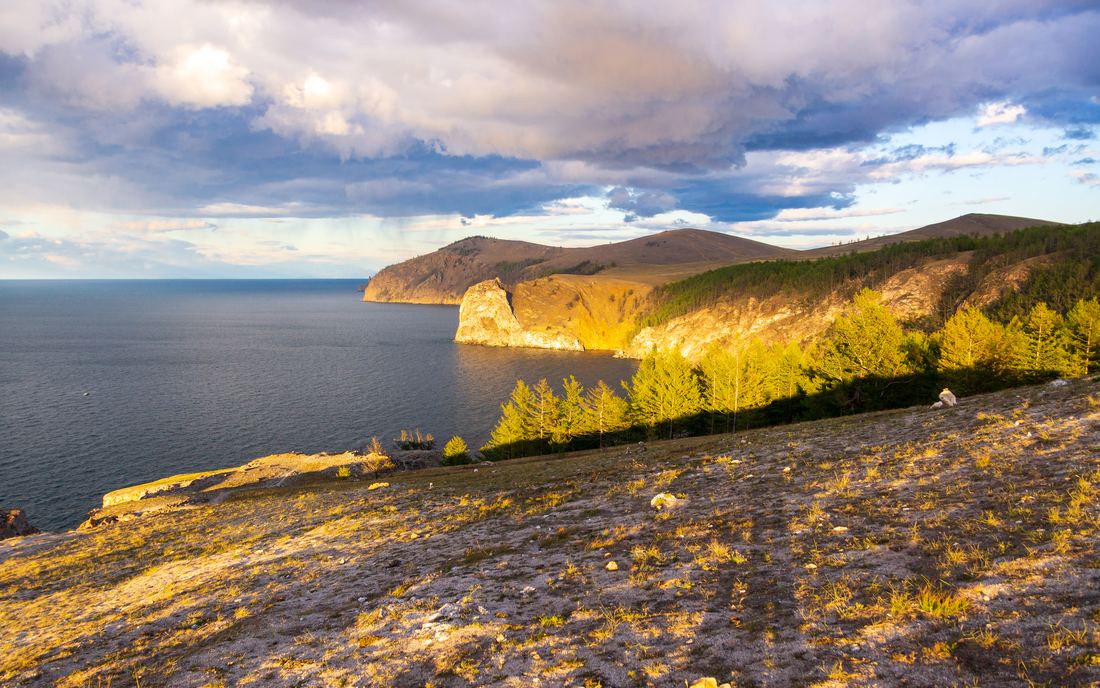
- Olkhon Island at sunset: Vyacheslav Argenberg, CC BY 4.0
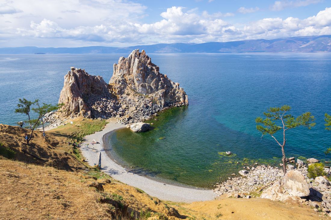
- Shaman Rock, Olkhon Island: Vyacheslav Argenberg, CC BY 4.0
- Short photos: Baikal, Cape Burhan, Olkhon Island, Lake Baikal, Russia.jpg - Vyacheslav Argenberg (CC BY 4.0) via Wikimedia Commons | Lake Baikal in winter.jpg - Sergey Pesterev (CC BY-SA 4.0) via Wikimedia Commons | Ice cave on Olkhon island.jpg - Sergey Pesterev (CC BY-SA 4.0) via Wikimedia Commons | Baikal ice on sunset.jpg - Sergey Pesterev (CC BY-SA 4.0) via Wikimedia Commons | Panorama of lake Baikal.jpg - Sergey Pesterev (CC BY-SA 4.0) via Wikimedia Commons | Lake Baikal, Maloye More Strait at sunrise, Baikal, Russia.jpg - Vyacheslav Argenberg (CC BY 4.0) via Wikimedia Commons | Olkhon Island, Capes, cliffs at sunset, Lake Baikal, Russia.jpg - Vyacheslav Argenberg (CC BY 4.0) via Wikimedia Commons | Shamanic ritual pillars at Cape Burhan, Olkhon Island, Lake Baikal.jpg - Vyacheslav Argenberg (CC BY 4.0) via Wikimedia Commons
Text written by Geographical Effect.