The Alps and the Matterhorn
Europe's great mountain arc. The Alps curve about 1,200 km across eight countries, and the Matterhorn is their icon. Geology, glaciers, first ascents and best seasons.
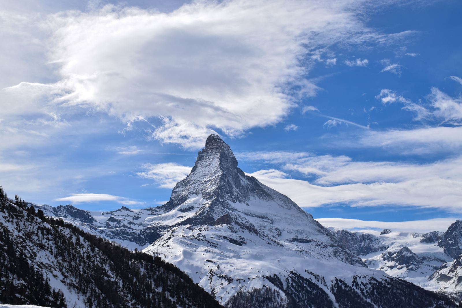
The Matterhorn in winter: Liridon, CC BY-SA 4.0
An arc of folded rock
The Alps curve about 1,200 km from the Mediterranean coast near Nice to the edge of Vienna, crossing France, Monaco, Italy, Switzerland, Liechtenstein, Germany, Austria and Slovenia. They formed as the African and European plates converged, folding and stacking slices of rock on top of one another like rumpled carpet.
The Matterhorn is a vivid example. Geologists describe its upper part as rock that came from the African side of the collision, now resting on top of European rocks. Ice age glaciers then cut into the mountain from several sides, carving four steep faces and leaving the sharp pyramid known around the world.
Video: Matterhorn | Switzerland Tourism (Switzerland), embedded from YouTube.
The story of the Matterhorn
At 4,478 m on the border between Switzerland and Italy, the Matterhorn is not the tallest peak in the Alps, but it was one of the last major summits to be climbed. On 14 July 1865 a party led by English climber Edward Whymper reached the top by the Hörnli ridge. On the way down a rope broke and four of the seven men fell to their deaths, a tragedy that made the mountain famous.
Today the Hörnli ridge is the standard route, usually climbed with a guide in July to September, starting from a hut at about 3,260 m. It is a serious climb that demands fitness, rock skills and an early start.
Glaciers in retreat
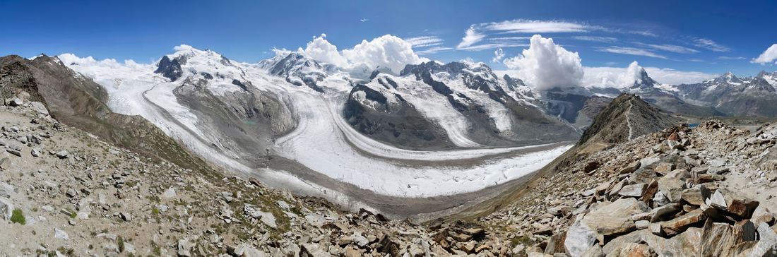
Glaciers shaped every Alpine valley, and they still feed the rivers that flow from the range, including the Rhine, Rhône and Po. But they are shrinking quickly. Swiss glaciers lost about a tenth of their remaining volume in just the two hot years of 2022 and 2023, and melting ice has exposed lost objects, old routes and even the remains of missing climbers.
Thawing permafrost is also loosening rock on high faces, making rockfall more common in hot summers. Mountain guides now regularly adjust or close routes during heat waves.
Visiting
Zermatt, at the foot of the Matterhorn, is a car-free village reached by train. From there, cable cars and the Gornergrat cog railway climb to viewpoints facing the mountain and the glaciers of Monte Rosa. The Five Lakes Walk offers famous reflections of the peak on calm mornings.
June to September is the season for hiking, with high passes usually clear of snow from July. Winter brings skiing across the Swiss and Italian sides of the mountain. Check the forecast: cloud can hide the Matterhorn for days at a time.
- Britannica: Matterhorn
- Britannica: Edward Whymper
- University of Zurich: Two catastrophic years obliterate 10% of Swiss glacier volume
- Wikipedia: First ascent of the Matterhorn
Facts on this page were checked against these sources.
- The Matterhorn in winter: Liridon, CC BY-SA 4.0
- Gorner Glacier, Monte Rosa and Matterhorn: Ximonic (Simo Räsänen), CC BY-SA 3.0
Text written by Geographical Effect.