Chile
The long, narrow country. Chile runs about 4,300 km from desert to glaciers yet averages under 180 km wide. How that strange shape packs in a huge range of climates.
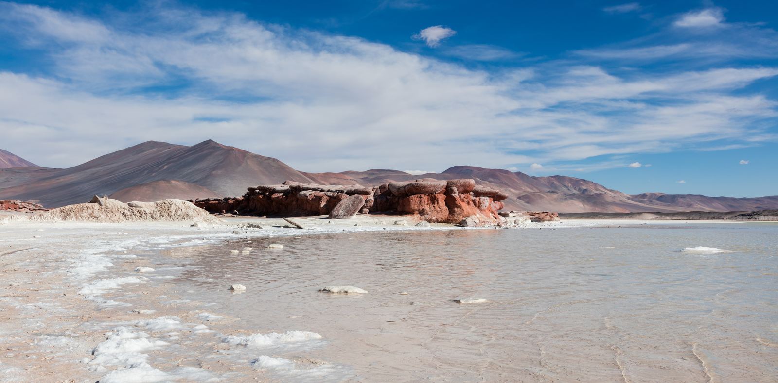
Piedras Rojas in the Atacama highlands: Diego Delso, CC BY-SA 4.0
A country shaped like a ribbon
Chile is one of the strangest shapes on the world map. Laid over Europe, it would stretch from Norway to North Africa, yet at its average point you could drive from the Pacific beach to the Andes border in an afternoon. The Andes wall it off on the east, the ocean on the west, the Atacama Desert in the north and the ice fields of Patagonia in the south.
That shape packs an extraordinary range of climates into one country. Travel its full length and you pass through some of the driest desert on Earth, a Mediterranean heartland of vineyards, temperate rainforest, fjords, glaciers and finally the windswept islands near Cape Horn.
Video: Chile Tourism Spot: Chile, Open Nature (Chile Travel), embedded from YouTube.
This country is over 4,000 km long but rarely 200 km wide
Chile is over 4,000 km long but averages under 200 km wide, spanning the Atacama Desert to Patagonian glaciers.
YouTube @GeographicalEffect (launching soon). Photos in this Short: Paisajes cerca de Calama, Chile, 2016-02-01, DD 84.JPG - Diego Delso (CC BY-SA 4.0) via Wikimedia Commons | Volcán Miñiques, Chile, 2016-02-08, DD 52-55 PAN.jpg - Diego Delso (CC BY-SA 4.0) via Wikimedia Commons | Cuernos del Paine in Torres del Paine National Park.jpg - Pedro Szekely from Los Angeles, USA (CC BY-SA 2.0) via Wikimedia Commons | Torres del Paine - Janvier 2010.jpg - Martin St-Amant (S23678) (CC BY-SA 3.0) via Wikimedia Commons | Catedrales de Tara, Chile, 2016-02-07, DD 62.JPG -
From the Atacama to the ice
The Atacama in the north sits in a double rain shadow: the Andes block moisture from the east, and the cold Humboldt Current off the coast chills the air so it rarely forms rain clouds. Some weather stations there have recorded almost no rainfall for years. The dry, high, clear air is why many of the world's largest telescopes are built on Chilean mountaintops.
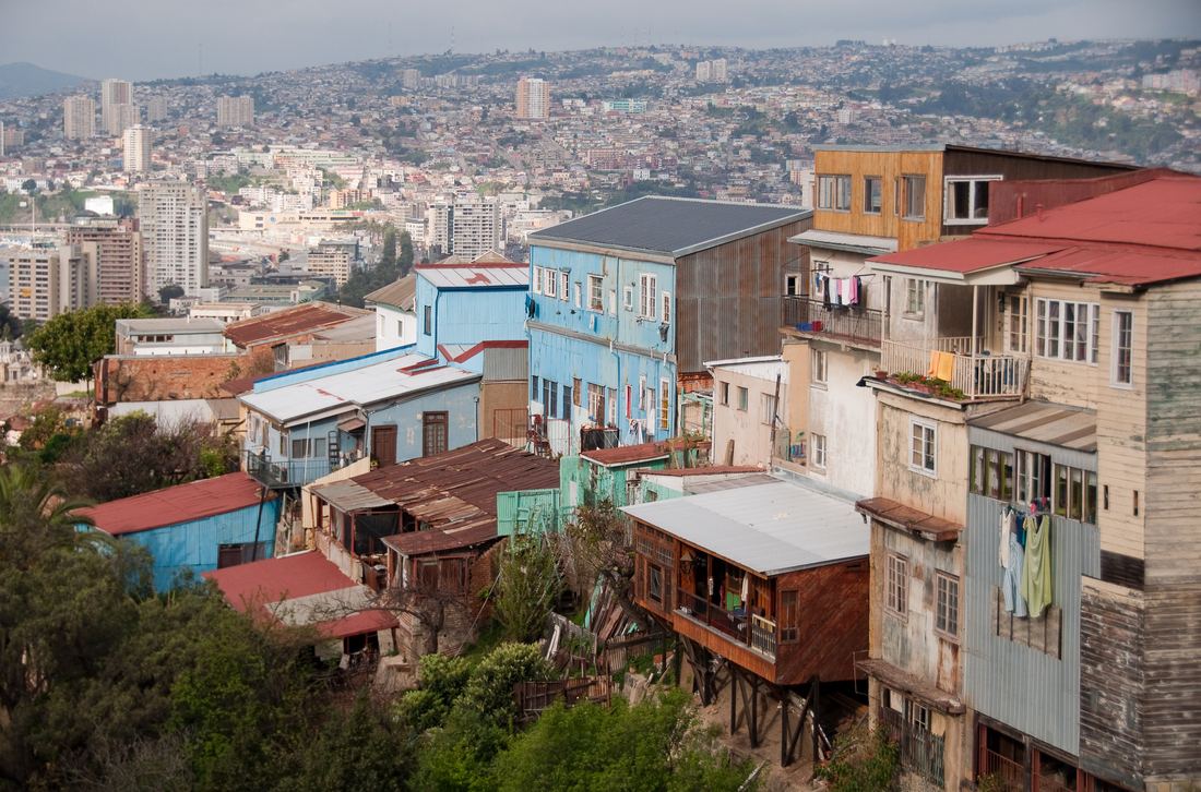
Central Chile, around Santiago and Valparaíso, has warm dry summers and mild wet winters, the same climate type as California and the Mediterranean. Most Chileans live here. Further south the rain increases sharply, forests thicken, and the coast breaks into thousands of islands and channels before reaching the glaciers and granite towers of Patagonia.
Living on the Ring of Fire
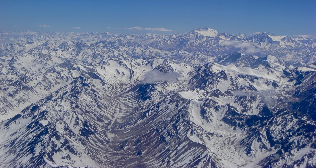
Chile sits where the Nazca Plate dives beneath South America, the same collision that lifted the Andes. The result is one of the most seismically active countries on the planet. The 1960 Valdivia earthquake, magnitude 9.5, is the strongest ever recorded, and Chile has dozens of active volcanoes.
Living with that risk has shaped the country: strict building codes, tsunami evacuation routes along the coast and a public that knows what to do when the ground starts to roll. The same geology brings wealth, too. Chile is the world's leading copper producer and holds major lithium deposits under its northern salt flats.
When and how to go
Because the country is so long, the right time depends on where you are heading. The Atacama is good year round, though nights are freezing. Santiago and the wine valleys shine in spring and autumn. Patagonia is best from December to February, when days are long and most trails and boats are running.
Domestic flights are the practical way to cover the distance, with long-distance buses for shorter hops. Pack layers wherever you go: a single day in Chile can swing from baking sun to icy wind.
Facts on this page were checked against these sources.
- Piedras Rojas in the Atacama highlands: Diego Delso, CC BY-SA 4.0
- The Andes in central Chile: Diego Delso, CC BY-SA 3.0
- Valparaíso from above: Roman Bonnefoy, CC BY-SA 4.0
- Short photos: Paisajes cerca de Calama, Chile, 2016-02-01, DD 84.JPG - Diego Delso (CC BY-SA 4.0) via Wikimedia Commons | Volcán Miñiques, Chile, 2016-02-08, DD 52-55 PAN.jpg - Diego Delso (CC BY-SA 4.0) via Wikimedia Commons | Cuernos del Paine in Torres del Paine National Park.jpg - Pedro Szekely from Los Angeles, USA (CC BY-SA 2.0) via Wikimedia Commons | Torres del Paine - Janvier 2010.jpg - Martin St-Amant (S23678) (CC BY-SA 3.0) via Wikimedia Commons | Catedrales de Tara, Chile, 2016-02-07, DD 62.JPG - Diego Delso (CC BY-SA 4.0) via Wikimedia Commons | Chile andes lake.jpg - Ram samudrala (CC BY-SA 4.0) via Wikimedia Commons | Kayakistas en Glaciar Grey.jpg - Pablo A. Cumillaf (CC BY-SA 4.0) via Wikimedia Commons | Miscanti Lagoon near San Pedro de Atacama Chile Luca Galuzzi 2006.jpg - Luca Galuzzi (Lucag) (CC BY-SA 2.5) via Wikimedia Commons
Text written by Geographical Effect.