The Appalachian Trail
About 2,200 miles from Georgia to Maine. The Appalachian Trail runs about 2,200 miles through 14 states, and only about 1 in 4 thru-hikers report finishing. Distance, permits and seasons.
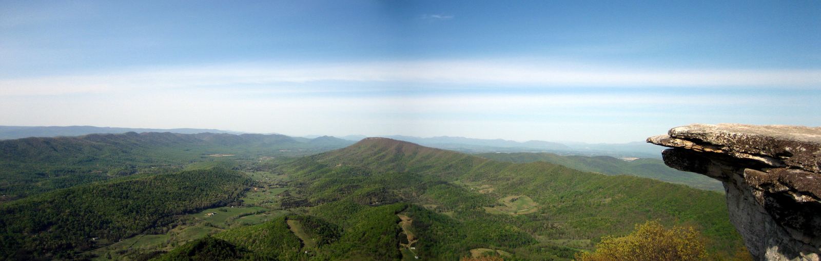
McAfee Knob, Virginia: Something Original, CC BY-SA 3.0
A footpath along an ancient range
The Appalachian Trail follows the crest of the Appalachian Mountains, one of the oldest mountain ranges on Earth. These ridges were once as tall as the Alps, but hundreds of millions of years of erosion wore them down to rounded, forested summits. The trail runs about 2,200 miles from Springer Mountain in Georgia to Katahdin in Maine, through 14 states.
The idea came from forester Benton MacKaye in 1921, and volunteers finished a continuous path in 1937. Today it is a national scenic trail maintained largely by volunteers working with the Appalachian Trail Conservancy, local clubs and the National Park Service. Its exact length changes slightly most years as sections are rerouted.
Video: Stewards of the Appalachian Trail | Appalachian Trail Conservancy (Appalachian Trail Conservancy), embedded from YouTube.
Only about 1 in 4 hikers finish this 2,000 mile trail
The Appalachian Trail runs about 2,200 miles through 14 states from Georgia to Maine; roughly one in four thru-hikers finish.
YouTube @GeographicalEffect (launching soon). Photos in this Short: Appalachian Trail, Peter's Mountain WV-VA.jpg - Smithh05 (CC BY-SA 4.0) via Wikimedia Commons | Appalachian Trail, Peter's Mountain WV-VA 4.jpg - Smithh05 (CC BY-SA 4.0) via Wikimedia Commons | Mount Katahdin.jpg - Michael Sipos (CC BY-SA 4.0) via Wikimedia Commons | Mount Katahdin - panoramio (2).jpg - Fredlyfish4 (CC BY-SA 4.0) via Wikimedia Commons | Appalachian National Scenic Trail (Vermont) (f37a5748-d122-4f49-99f1-f13a6d68fb3f).jpg - Victoria Stauffenberg (Public domain) via Wikimedia Com
Why so few finish
Thousands of people start a thru-hike every year, but only about one in four reports finishing to the Appalachian Trail Conservancy. The challenge is not one big mountain but endless steep climbs and descents. Added together, the gain and loss equal climbing Everest from sea level and back about sixteen times.
Injuries, money, homesickness, rain that lasts for days and plain exhaustion stop many hikers. Others plan from the start to section-hike, covering the trail over years. The trail is also popular for short walks: millions of people hike some part of it every year.
Highlights along the way
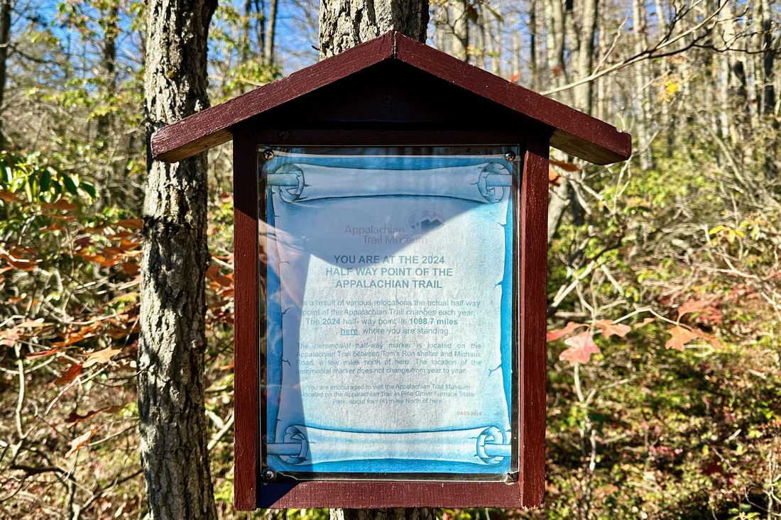
In the south, the trail crosses the Great Smoky Mountains and tops out at Clingmans Dome, the highest point on the route. Virginia holds the most miles, along with famous viewpoints such as McAfee Knob. Harpers Ferry in West Virginia is the trail's rough psychological midpoint, though the official halfway point sits in Pennsylvania.
Pennsylvania is known for sharp, ankle-twisting rocks. New Hampshire's White Mountains and the open ridges of the Presidential Range bring some of the most exposed weather in the eastern United States, and southern Maine's Mahoosuc Notch is often called the hardest mile on the trail.
Permits and planning
No single permit covers the whole trail, but a few areas require one. Thru-hikers need a backcountry permit for Great Smoky Mountains National Park, a paid permit, booked on Recreation.gov, is required for overnight stays in Shenandoah National Park, and hikers ending at Katahdin must register with Baxter State Park. The Appalachian Trail Conservancy runs a voluntary registration system to spread out start dates.
Most thru-hikers go northbound, starting in Georgia in March or April and aiming to reach Katahdin before Baxter State Park closes the summit trail in mid-October. For a day or weekend hike, late spring and autumn bring the best weather and color.
- Appalachian Trail Conservancy: A.T. Basics
- Appalachian Trail Conservancy: Appalachian Trail Becomes a Half Mile Longer in 2026
- Appalachian Trail Conservancy: Thru-Hiker FAQs
- Appalachian Trail Conservancy: Shenandoah NP Backcountry Permit Changes and Fee
Facts on this page were checked against these sources.
- McAfee Knob, Virginia: Something Original, CC BY-SA 3.0
- The 2024 halfway marker: Zeete, CC BY-SA 4.0
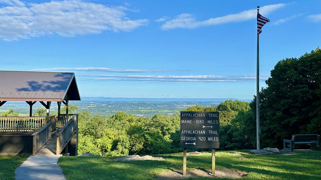
- Pen Mar Park, Maryland: Zeete, CC BY-SA 4.0
- Short photos: Appalachian Trail, Peter's Mountain WV-VA.jpg - Smithh05 (CC BY-SA 4.0) via Wikimedia Commons | Appalachian Trail, Peter's Mountain WV-VA 4.jpg - Smithh05 (CC BY-SA 4.0) via Wikimedia Commons | Mount Katahdin.jpg - Michael Sipos (CC BY-SA 4.0) via Wikimedia Commons | Mount Katahdin - panoramio (2).jpg - Fredlyfish4 (CC BY-SA 4.0) via Wikimedia Commons | Appalachian National Scenic Trail (Vermont) (f37a5748-d122-4f49-99f1-f13a6d68fb3f).jpg - Victoria Stauffenberg (Public domain) via Wikimedia Commons | Appalachian National Scenic Trail (Vermont) (04d564e3-b8d5-4940-9fa3-a063b7234a83).jpg - Victoria Stauffenberg (Public domain) via Wikimedia Commons | Blue Ridge Parkway clouds VA1.jpg - Acroterion (CC BY-SA 4.0) via Wikimedia Commons | View of Blue Ridge Mountains from Sassafras Mountain 20160701 1.jpg - DXR (CC BY-SA 4.0) via Wikimedia Commons
Text written by Geographical Effect.